
San Antonio School Districts Maps
If you have been searching left and right for a quality map of the school districts here in San Antonio, look no further. Here at BestSAHomes, our staff is hard at work to provide the utmost in services to both clients and community alike. Therefore, we have created and compiled some of the most accurate maps of the local school districts on the web! In fact, these are some of the only interactive school maps for these districts on the internet! Our maps are updated regularly, adding important information pertaining to each school district as it is released. These are fully interactive maps, unlike most of the PDF maps the districts provide online.
NOTE: Currently our maps are only high school attendance boundaries. But do not worry, as time progresses, we plan to expand our maps to include both middle and elementary schools. Stay tuned for constant updates!
NEISD Boundary Maps
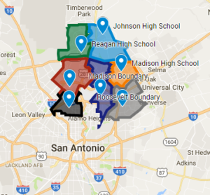
North East Independent School District is located in the upper north side of San Antonio. It is home to some of the most high-ranking high schools in the city. Search your home and see which school boundaries you belong to!
Click here to view map.
NISD Boundary Maps
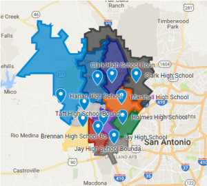
Northside Independent School District is located on the north west side of San Antonio. It is the largest school district in the city, with bounds reaching into Bandera and Kendall counties. Search your home and see which school boundaries you belong to!
Click here to view map.
Alamo Heights Boundary Maps
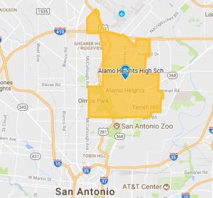
Alamo Heights Independent School District is located in the historic Central San Antonio. It is home to an award winning exemplary high school, and is in one of the most prestigious parts of San Antonio. Search your home and see which school boundaries you belong to!
Click here to view map.